Mixed reality application for a major defense and security group: collaborative tactical mapping
One of the world's leading defense and security groups was looking to revolutionize the way command staffs prepare and coordinate their operations. The challenge was to enable several decision-makers to simultaneously visualize and manipulate a complex tactical situation within a shared environment.
The challenge: transforming the briefing room
Traditional military briefings rely on static maps, 2D screens and physical scale models. These tools come with significant limitations:
- Difficulty representing real-time data
- No way to dynamically simulate unit movements
- Lack of interactivity for testing different scenarios
- Limited collaboration between participants
The solution: collaborative mixed reality
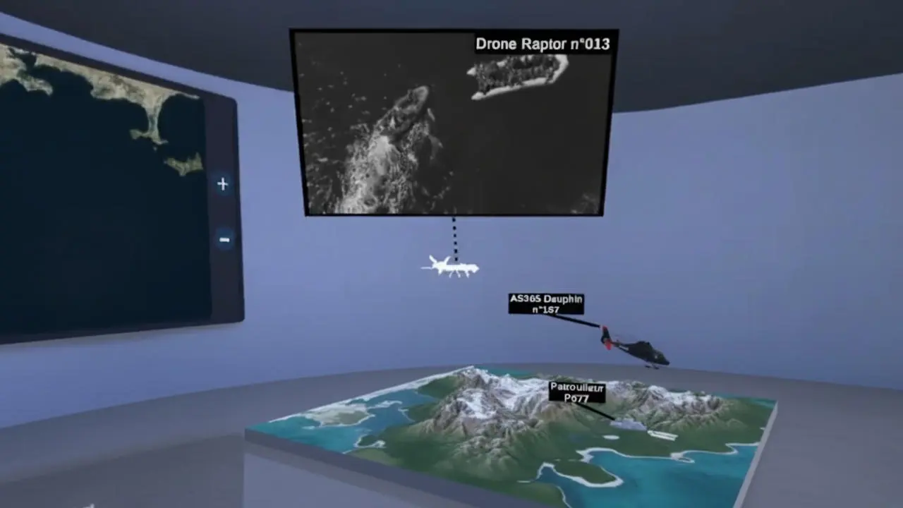
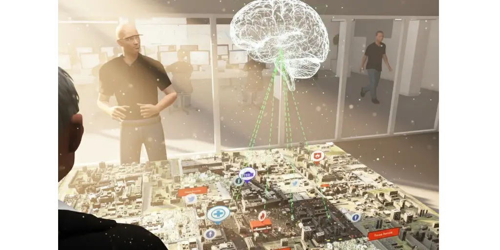
I developed a mixed reality application prototype for Microsoft HoloLens headsets, enabling 4 equipped participants to visualize and manipulate a shared 3D tactical map in real time within the same room.
Much like an Apple Vision Pro, the concept was groundbreaking: a holographic scale model appears at the center of the physical room as an overlay, visible to all participants simultaneously. Each person can interact with it, and all actions are instantly reflected on every team member's headset.
Features developed
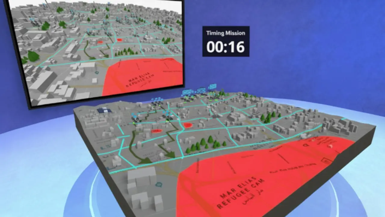
Demo mode: several pre-configured tactical scenarios with automatic animations showing the evolution of a situation (troop movements, operation progression, communication flows...)
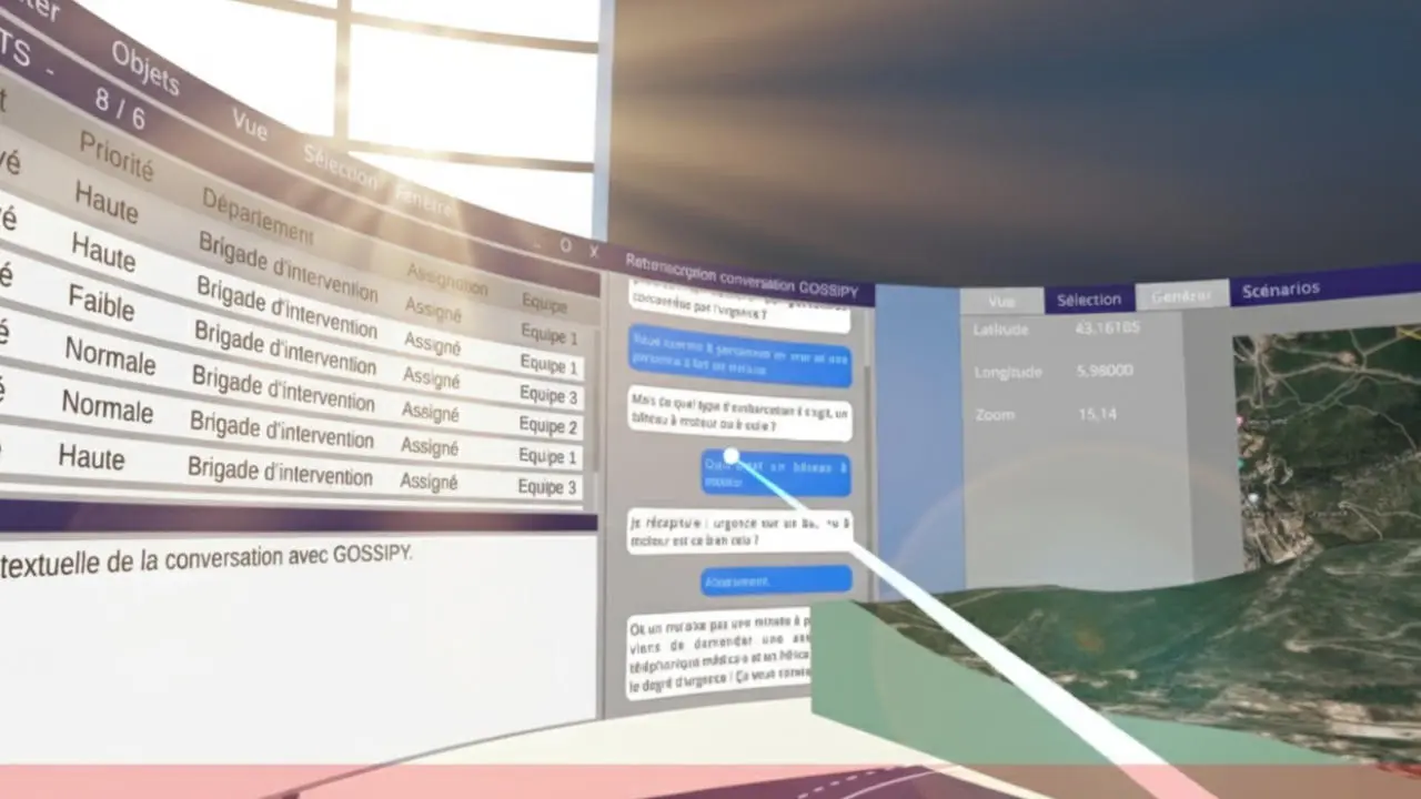
Natural interaction: direct hand manipulation, with no controller required. Participants use virtual laser pointers to select and move units, creating an intuitive and fluid experience.
Multi-scale navigation: progressive zoom allowing users to shift from a strategic overview to a detailed tactical view of a specific area, revealing different levels of information depending on scale.
Spatial configuration: free positioning of the map within the real-world space of the room, with the placement of companion virtual screens displaying contextual data (weather, communications, available resources...).
Collaborative synchronization: real-time network architecture where every action (unit movement, trajectory change, activation of communication flows) is instantly visible to all participants, supporting collective decision-making.
Communication flow visualization
A particularly innovative aspect concerned the representation of wireless communication flows between units. Participants could:
- Visualize active communication networks in 3D
- Identify coverage areas and blind spots
- Optimize unit positioning to maintain connectivity
Operational impact
This prototype generated strong enthusiasm when presented for its potential to transform tactical briefings, among other use cases:
- Accelerated situational understanding: spatial 3D allows complex situations to be grasped instantly
- Enhanced collaboration: all participants see and manipulate the same model, eliminating ambiguity. Mixed reality offers a major advantage over fully immersive VR: participants remain connected to the real world and can interact naturally with their surroundings (consulting physical screens, communicating with unequipped colleagues, taking notes) while simultaneously manipulating holographic data.
- Real-time simulation: the ability to test multiple action plans within minutes
- Informed decision-making: clear visualization of the consequences of each tactical choice
Technical challenges overcome
Developing for HoloLens in a multi-user environment presented several complexities:
- Spatial synchronization: ensuring all participants see the model at the same location in the room
- Network performance: latency below 50ms, essential for smooth collaboration
- Concurrent interaction management: arbitration when multiple users simultaneously manipulate nearby elements
- Graphical optimization: maintaining 60 fps on the HoloLens' limited processor while rendering hundreds of units and communication flows
This achievement demonstrates the potential of mixed reality for mission-critical applications where collaboration and spatial understanding are essential.
3D applications for defense and security
The defense sector has specific needs where immersive 3D delivers invaluable value.
Mission briefing and debriefing
Before an operation, teams can:
- Visualize terrain in 3D with real geospatial data
- Run through different intervention scenarios
- Identify critical points and potential risks
- Coordinate the movements of each unit
After the operation, the after-action review (AAR) can be conducted immersively:
- 3D reconstruction of the intervention
- First-person perspective for each participant
- Analysis of tactical decisions
- Identification of areas for improvement
Tactical training and exercises
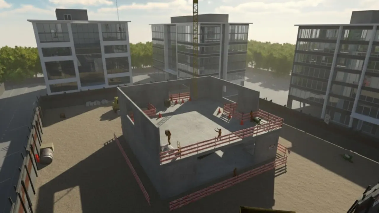
The developed modules enable teams to:
- Script varied situations (terrain types, weather conditions, threat categories)
- Train reflexes under pressure in a safe environment
- Repeat procedures on costly equipment without mobilizing it
- Objectively evaluate individual and collective performance
Crisis cell and virtual command room
In emergency situations, decision-makers can instantly convene in a secure virtual space to:
- Visualize the situation in real time on 3D maps
- Share classified information
- Coordinate the actions of multiple units
- Run simulations of different resolution scenarios
A standard PC and an internet connection are all that is needed to join the virtual command room, enabling maximum responsiveness.
Looking ahead: AI at the heart of mixed reality
The convergence of mixed reality and artificial intelligence opens up major strategic possibilities for the defense and industrial sectors:
-
Real-time predictive analytics: integrating forecasting models enables the instant simulation of the most probable trajectories of adversarial units, displayed directly on the holographic tactical table.
-
Tactical conversational agents: LLMs (Large Language Models) integrated into the headset allow officers to query their environment in natural language: "Show me the radio blind spots if I move this unit 2km north."
-
Augmented computer vision: AI analyzes headset video feeds to automatically identify and label equipment or potential threats, reducing the cognitive load on field personnel.
-
AI-generated training scenarios: instant creation of complex training variants based on real mission reports, transforming the after-action review into an immediate interactive simulation.
Ready to take the leap into innovation?
Whether it's revolutionizing your tactical briefings, designing AI-driven digital twins or developing high-fidelity training modules, your project deserves expertise that fuses immersive hardware with software intelligence.
Through my studio Tridimotion, I don't just deliver an application — I build with you an ecosystem where spatial 3D meets the power of agentic AI. From feasibility validation (POC) to the deployment of secure multi-user solutions on AWS, I support you at every stage of your digital transformation.
Ready to give your operations a new dimension? Let's talk about your ambitions and turn your critical data into impactful decision-making experiences.
This article is part of a series on my professional experiences in developing innovative solutions. To discover more projects, visit my portfolio..